The Spanish Bight: Coronado's Lost Waterway
When Coronado Was Two Separate Islands Divided by Roaring Pacific Swells
For centuries before the outbreak of World War II, the land today known as Coronado was not a single unbroken peninsula. It consisted of two distinct landmasses (North Island and Coronado proper) severed by a shallow, dynamic saltwater strait known on maritime navigational charts as the Spanish Bight. Here is the documented chronicle of the forgotten channel, from Spanish galleon charts to the 28-million-cubic-yard wartime engineering feat that wiped it off the map forever.
Listen to the historical narrative via browser voice narration
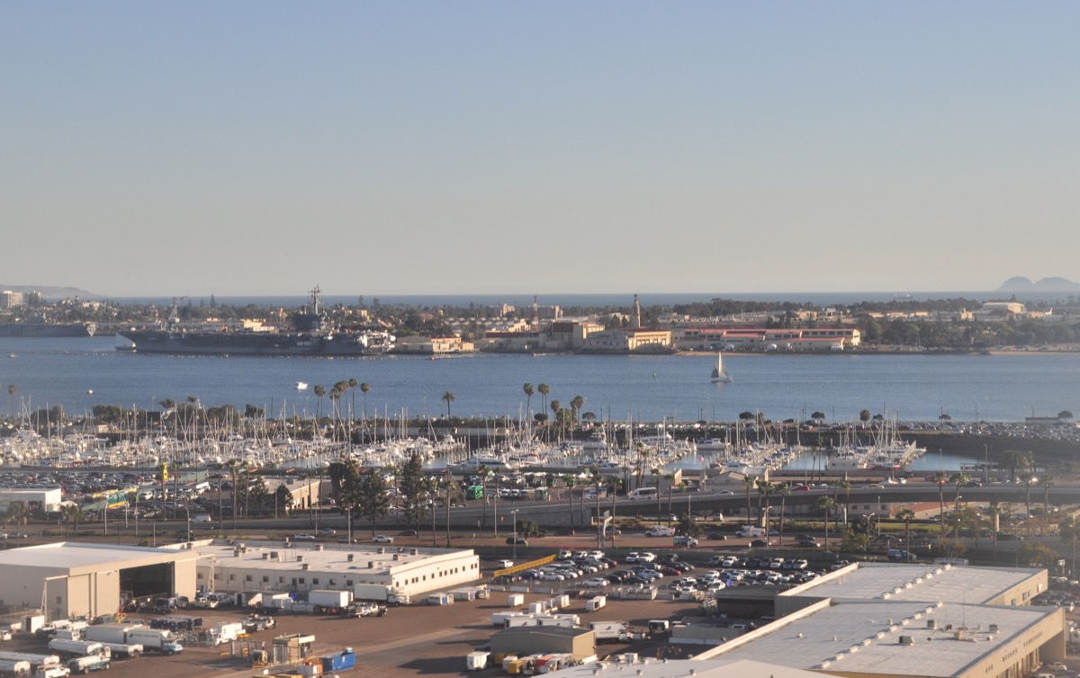
Aerial perspective of the natural tidal waterway that once separated North Island from South Island before being filled for military runways during World War II.
1. The Dynamic Saltwater Strait (1542-1886)
When early European navigators rounded Point Loma, beginning with Juan Rodríguez Cabrillo in 1542 and Sebastian Vizcaíno in 1602, their hand-drawn charts consistently portrayed the Coronado landmass as severed into two pieces. The southern island, anchored by the long peninsula of the Silver Strand, terminated at a wide saltwater inlet. Across that inlet lay an uninhabited, brush-covered barrier island of sand dunes, sagebrush, and nesting sea fowl, referred to colloquially by Spanish soldiers as Isla del Norte (North Island).
The waterway linking the Pacific Ocean to San Diego Bay was named the Spanish Bight. Driven by powerful tidal ebbs and winter storm swells, the channel was dynamic and mercurial. At spring low tides, the strait would narrow into a network of winding tidal pools, eelgrass mudflats, and sandbars shallow enough for adventurous horse riders or livestock to wade across. But when full moon swells swept through from the open sea, the Bight deepened into a surging, frothing ocean channel several fathoms deep, spanning over 1,200 yards wide.
For the Kumeyaay people who camped seasonally along the Coronado peninsula for millennia, the Spanish Bight was an extraordinarily productive marine pantry. The calm, brackish shallows formed a nursery for Pismo clams, scallops, bay rays, and juvenile halibut. Archaeological digs in the 1930s uncovered massive shell middens along the former southern shore of the Bight, confirming centuries of seasonal maritime harvesting before European colonization.
2. Babcock's Hunting Grounds & The Quarantine Barrier
When Elisha Babcock Jr. and Hampton L. Story bought the peninsula at auction in December 1885 for $110,000, they purchased both North and South Coronado. While they poured millions into laying out the grand avenues, water pipelines, and foundations of the Hotel del Coronado on the South Island, North Island remained a wild, pristine wilderness.
Babcock cherished North Island as an exclusive private game preserve. Hundreds of thousands of migrating Pacific brant, canvasback ducks, and curlews rested in the marshes lining the Spanish Bight. Babcock and his wealthy Chicago guests would take small rowboats across the Bight at sunrise, or wait for slack low water to drive high-wheeled hunting wagons across the sandy ford.
"The Spanish Bight was our moat. North Island was a kingdom of wild brush and roaring surf where no streetcar could reach and no tourist could wander uninvited." - Elisha S. Babcock Jr., Reminiscences of Coronado Beach (1894)
During the smallpox and yellow fever scares of the 1890s, the Spanish Bight served as a natural geographic quarantine boundary. City public health officials considered North Island the ideal sanitary quarantine station because the treacherous currents of the Bight made unauthorized escape or civilian contact virtually impossible.
3. Why Glenn Curtiss Chose North Island in 1911
The natural isolation afforded by the Spanish Bight played an accidental, foundational role in the history of global warfare: the birth of American naval aviation. In December 1910, inventor and aviation pioneer Glenn H. Curtiss struck an agreement with John D. Spreckels to establish a winter aviation camp free of charge on North Island.
Curtiss selected North Island over hundreds of competing coastal sites for two decisive physical reasons directly dictated by the Spanish Bight:
- 1. Absolute Seclusion from Patent Competitors: Curtiss was locked in fierce, bitter patent litigation with the Wright Brothers. Because North Island could only be reached by boat across the Bight or San Diego Bay, Curtiss could station guards at the boat landings and test experimental wing warps and pontoons in total secrecy.
- 2. Mirror-Calm Takeoff Basins: The rudimentary floats of early hydroaeroplanes could not survive ocean surf. The protected embayment of the Spanish Bight provided mirror-smooth salt water unaffected by open-sea breakers, allowing Curtiss to execute the world's first successful seaplane takeoff and landing on January 26, 1911.
Within weeks, Curtiss trained the first naval aviator, Lt. Theodore G. Ellyson, USN, and on February 17, 1911, Curtiss flew his hydroaeroplane from the calm waters of the Spanish Bight out to the armored cruiser USS Pennsylvania anchored in San Diego Bay, where the plane was hoisted aboard by crane and launched back into the water, proving the concept of carrier aviation.
Wartime Transformation: Spanish Bight Technical Ledger
| Specification | Pre-1944 Natural State | 1944-1945 Wartime Dredge Project |
|---|---|---|
| Waterway Status | Tidal ocean-to-bay saltwater strait | 100% Infilled & Unified Landmass |
| Channel Length & Width | 1.2 miles long; 400-1,200 yards wide | Completely eliminated |
| Fill Volume | N/A (Natural sandbars & silt) | 28,000,000 cubic yards |
| Dredging Machinery | None | Hydraulic cutterhead pipeline dredges |
| Runway Accommodation | Short grass airstrips (under 3,000 ft) | 8,000-ft concrete heavy bomber runways |
| Modern Topography | Dynamic marine estuary | NAS North Island Sea 'N Air Golf Course |
4. Erasing a Strait for Pacific Victory
Following the attack on Pearl Harbor on December 7, 1941, Naval Air Station North Island emerged as the supreme logistics, repair, and staging hub for the entire United States Pacific Fleet. Every aircraft carrier deploying into combat in the Pacific, from the USS Enterprise (CV-6) to the USS Lexington (CV-2) and USS Yorktown (CV-5), called at North Island to take on aircraft squadrons, munitions, spare engines, and aircrews.
By 1943, however, naval aviation had radically transformed. Lightweight biplanes were replaced by massive, multi-engine heavy patrol bombers and long-range transport aircraft, including the four-engine Consolidated PB2Y Coronado flying boat and the land-based Consolidated PB4Y-2 Privateer. These aircraft required uninterrupted 8,000-foot paved runway complexes aligned with prevailing ocean winds.
North Island's constrained borders, choked off by the tidal waters of the Spanish Bight, could not accommodate the necessary runway extensions. The U.S. Navy Bureau of Yards and Docks faced an unprecedented engineering decision: bridge the channel, or erase it entirely.
In early 1944, a massive fleet of 24-hour hydraulic cutterhead dredges went to work in San Diego Harbor. Steel pontoon discharge pipelines were laid across the bay. Night and day, the dredges sucked millions of tons of bay-floor sediment, sand, and shells, pumping high-pressure slurries directly into the mouth of the Spanish Bight. Over the course of 18 months, an astonishing 28 million cubic yards of marine fill were deposited into the strait.
By mid-1945, the Spanish Bight was no more. The water ceased to flow; the tidal currents were extinguished; and North Island and South Island were welded into a single unbroken physical peninsula. Across the newly settled land, Navy construction battalions poured thousands of tons of reinforced concrete, completing the runway intersections that sustained the final naval offensives against the Japanese home islands.
5. Where Does the Spanish Bight Sleep Today?
Today, hundreds of cars traverse the buried footprint of the Spanish Bight every hour without realizing they are driving over 40 feet of wartime dredge fill. The historic centerline of the strait runs directly underneath the main gate of Naval Air Station North Island, continuing across the fairways of the Sea 'N Air Golf Course, through the military housing developments, and out toward the beach near Breakers Field.
If you stand at the corner of Alameda Boulevard and 4th Street in Coronado and look northwest toward the airfield, you are gazing directly along the axis of the ancient waterway where Spanish sailors anchored, where Kumeyaay families paddled reed canoes, and where Glenn Curtiss launched the age of naval aviation.
Share Chronicle & Academic Citation
Distribute verified Coronado historical records or cite this resource in academic, educational, and journalistic works.