
The Silver Strand & Kumeyaay Heritage
Ten Millennia of Maritime Tradition on the Seven-Mile Pacific Sand Spit
Long before Spanish sails appeared on the Pacific horizon, the narrow, seven-mile tombolo connecting Coronado to the mainland at Imperial Beach was known, navigated, and revered by the Kumeyaay people. Known geologically as the Silver Strand, this dynamic ribbon of shifting dunes, saltwater marshes, and ocean surf represents more than 10,000 years of unbroken human coastal history.
Listen to the historical narrative via browser voice narration
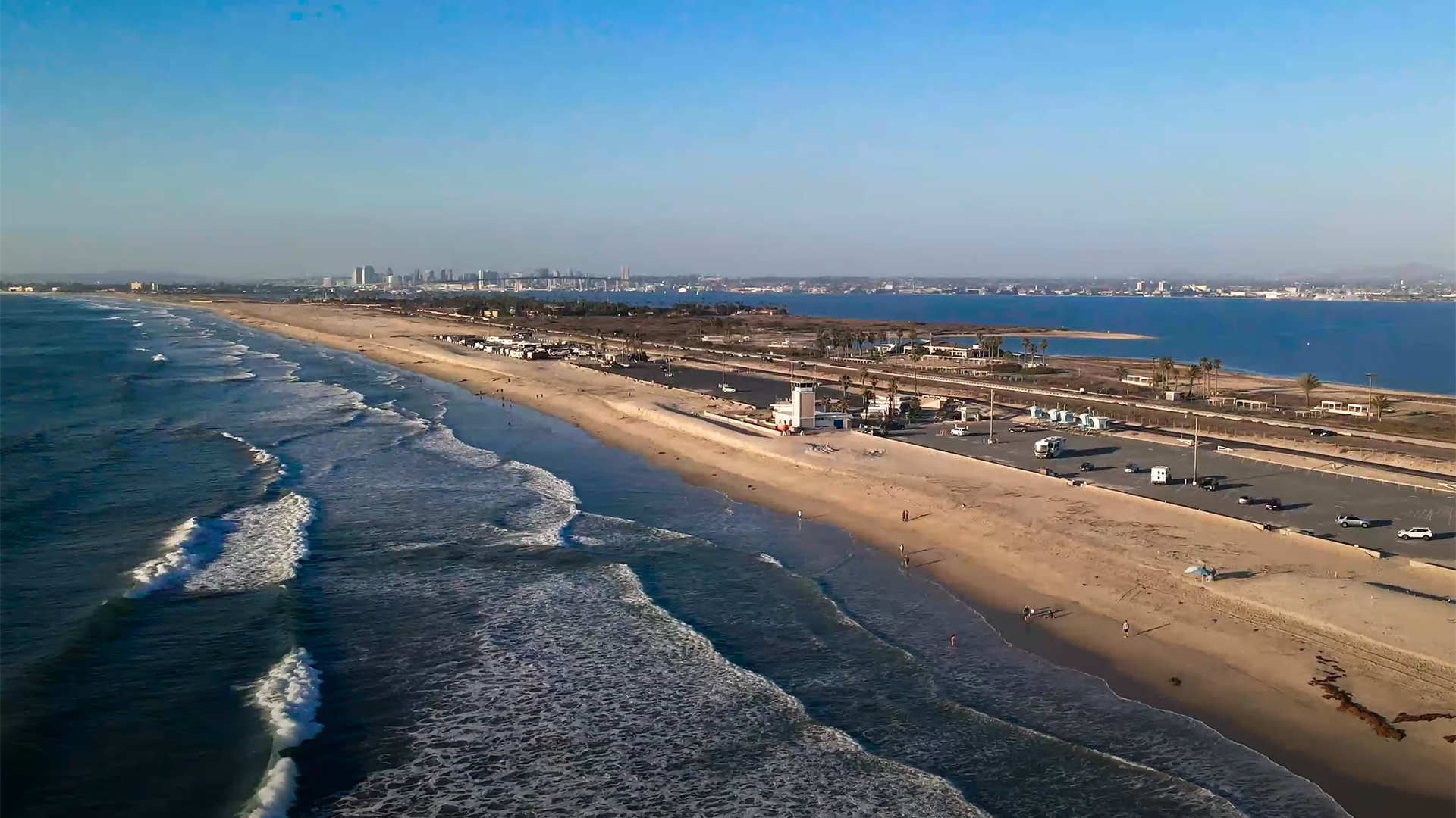
The narrow Silver Strand isthmus connecting Coronado to the mainland, stewarded by the Kumeyaay people for over 10,000 years.
1. Kumeyaay Maritime Camps & Seasonal Harvests
Archaeological surveys and carbon dating along the Silver Strand, Glorietta Bay, and the Crown City shoreline establish that indigenous Kumeyaay (Tipai-Ipai) peoples have stewarded this peninsula for well over 10,000 years. Rather than permanent year-round fortifications, the Kumeyaay utilized an intricately balanced seasonal migration network linking the Pacific Ocean, the coastal coastal sage scrub valleys, and the high acorn forests of the Cuyamaca and Laguna mountains.
Each spring and summer, extended family clans traveled down along the river corridors to establish coastal camps on the Silver Strand dunes. Living in lightweight, dome-shaped brush shelters called 'ewaa, they were master maritime navigators. Kumeyaay fishers constructed buoyant canoes called ha kwai by binding dried stalks of native tule reeds (Schoenoplectus acutus) with twisted milkweed fiber ropes.
Propelling these resilient craft with double-bladed paddles across the glassy waters of San Diego Bay and along the outer reefs, they harvested rich catches of corvina, striped mullet, shovelnose guitarfish, and stingrays using bone gorge hooks, agave-fiber nets, and sharpened mesquite spears. Along the shallows of Glorietta Bay and the Silver Strand flats, women and children gathered millions of Pismo clams, purple olive snails, and bay mussels. Large shell middens documented by early 20th-century ethnologists testified to centuries of sun-drying seafood for winter trade across mountain trails to Colorado River tribes.
2. Geological Formation of the Seven-Mile Tombolo
Geologically, the Silver Strand is defined as a classic tombolo: a depositional landform in which an island is attached to the mainland by a narrow spit of sand. It is one of the longest and most distinct tombolos in North America.
The engine of the Silver Strand was the mighty Tijuana River watershed. Over thousands of years, heavy winter rains in the mountains of Baja California and San Diego County flushed massive quantities of quartz and feldspar sands down the river into the Pacific Ocean. Once discharged into the sea, longshore wave energy propelled this sediment northward, building a seven-mile natural barrier dike that closed off San Diego Bay from the open ocean swells.
The poetic title "Silver Strand" was popularized in the 1880s by Victorian visitors and journalists. When bright afternoon sunlight strikes the wet shoreline, billions of microscopic iridescent mollusk and oyster shell fragments embedded in the quartz sands glitter with a brilliant metallic sheen, creating the unmistakable illusion of a gleaming silver ribbon.
The Silver Strand: Ecological & Historical Technical Ledger
| Parameter | Historical / Ecological Metric | Significance |
|---|---|---|
| Geological Classification | Wave-Dominated Coastal Tombolo | Connects Coronado to Imperial Beach mainland |
| Total Tombolo Length | 7.0 Miles (11.2 km) | Forms the western protective wall of San Diego Bay |
| Indigenous Watercraft | Ha Kwai (Tule Reed Balsa Canoes) | 10,000+ years of bay and ocean fishing |
| State Park Unit Status | Unit #543 (Established 1932) | 2.5 miles of dual-shoreline public access |
| Endangered Species Habitat | Snowy Plover & Least Tern | Federally protected sand dune nesting sanctuaries |
| Military Presence | Naval Amphibious Base Coronado (1943) | U.S. Navy SEAL training ground (BUD/S) |
3. Silver Strand State Beach & Conservation
In the 1920s, as automobile traffic surged along the newly paved Silver Strand Highway, civic leaders recognized the urgent need to protect this fragile coastline from runaway commercial exploitation. In 1932, the California State Parks Commission officially created Silver Strand State Beach (Unit #543), dedicating 2.5 miles of pristine beach frontage to the people of California.
Uniquely situated between the roaring Pacific Ocean on the west and the tranquil, warm waters of San Diego Bay on the east, Silver Strand State Beach became an immediate haven for camping, surf fishing, and water skiing. Pedestrian tunnels beneath the highway allowed visitors to move effortlessly between the ocean surf and the placid bay.
Today, the Silver Strand is recognized internationally as an essential sanctuary for threatened coastal avian species. The Western Snowy Plover (Charadrius nivosus nivosus) and the endangered California Least Tern (Sternula antillarum browni) nest directly on the open sand dunes between March and September. Fenced conservation preserves protect these tiny ground-nesting birds, while park rangers and volunteer biologists monitor clutches to ensure the survival of chicks against coastal predators.
4. Naval Amphibious Base & The SEAL Sand Dunes
In 1943, at the height of World War II, the northern segment of the Silver Strand was commissioned as the Naval Amphibious Training Base Coronado. Thousands of landing craft crews, beachmasters, and underwater demolition teams trained on these exact dunes before deploying to storm the beaches of Normandy, Iwo Jima, and Okinawa.
Today, the base remains the premier headquarters of Naval Special Warfare Command. The sands of the Silver Strand are world-famous as the proving grounds for Basic Underwater Demolition/SEAL (BUD/S) training. Trainees endure relentless ocean boat drills, soft-sand runs with telephone poles, and the legendary "Hell Week" on the very same shores where Kumeyaay scouts watched Spanish caravel masts emerge over the horizon four centuries ago.
5. Land Acknowledgement & Cultural Sources
The City of Coronado and the Silver Strand occupy the unceded ancestral territory of the Kumeyaay Nation, whose descendants continue to live throughout San Diego and Imperial counties and northern Baja California. We honor their ten-thousand-year stewardship of these coastal waters, lagoons, and beaches.
Share Chronicle & Academic Citation
Distribute verified Coronado historical records or cite this resource in academic, educational, and journalistic works.