
Sebastián Vizcaíno Maps Bay & Names Coronado
Spanish naval explorer Sebastián Vizcaíno charts San Diego Bay, surveys the Coronado sandspit, and names Los Coronados in honor of the Four Crowned Martyrs.
Listen to the historical narrative via browser voice narration
Archival Chronicle & Historical Significance
Historical Chronicle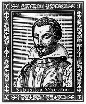
Spanish naval explorer Sebastian Vizcaino who mapped San Diego Bay and named Los Coronados in 1602.
In May 1602, under direct royal orders from the Viceroy of New Spain, General Sebastián Vizcaíno departed Acapulco commanding three Spanish vessels: the flagship San Diego, the Santo Tomás, and the frigate Tres Reyes. Their mission was to conduct the first systematic cartographic and hydrographic survey of Alta California to secure safe anchorages for the treasure-laden Manila galleons returning across the Pacific from the Philippines.
On November 8, 1602, the lookout aboard the San Diego sighted a chain of four rugged, rocky islands rising dramatically out of the coastal waters southwest of the harbor entrance. Because that day coincided on the liturgical calendar with the feast of Los Cuatro Santos Coronados (the Four Crowned Martyrs of Roman antiquity), Vizcaíno officially recorded them in his navigation logs as "Islas Coronados." Two days later, on November 10, the three ships navigated past the Point Loma headland into the calm harbor. Vizcaíno anchored near modern Ballast Point, celebrated Catholic Mass in a tent chapel on the sand, and renamed the harbor "San Diego" in honor of his flagship and San Diego de Alcalá, replacing Cabrillo's 1542 designation of San Miguel.
During their ten-day anchorage, Vizcaíno's chief cosmographer, Father Antonio de la Ascensión, and chief pilot Francisco de Bolaños conducted detailed boat surveys across the entire bay. They rowed along the natural sandspit of Coronado, charting the narrow tidal channel of Spanish Bight and taking depth soundings across the entrance channel. Their hydrographic charts documented the low sand dunes, the extensive eelgrass beds, and the tidal shallows sheltering the inner bay from Pacific swells.
Although Vizcaíno specifically designated the offshore islands as Los Coronados, the poetic name forever defined the surrounding geographic realm. When founders Elisha Babcock and Hampton Story purchased the peninsula in 1885, they chose the Spanish word "Coronado" (meaning "The Crowned One") as the permanent civic name. What began in Vizcaíno's 1602 navigation logbook evolved into the modern identity of the Crown City, linking centuries of Pacific exploration directly to the historic avenues and beaches we explore today.
On-Location Photographic Suite (2 Archival Photographs)
Record #1 Portrait of General Sebastian Vizcaino
Spanish naval explorer Sebastian Vizcaino who mapped San Diego Bay and named Los Coronados in 1602.
 Record #2
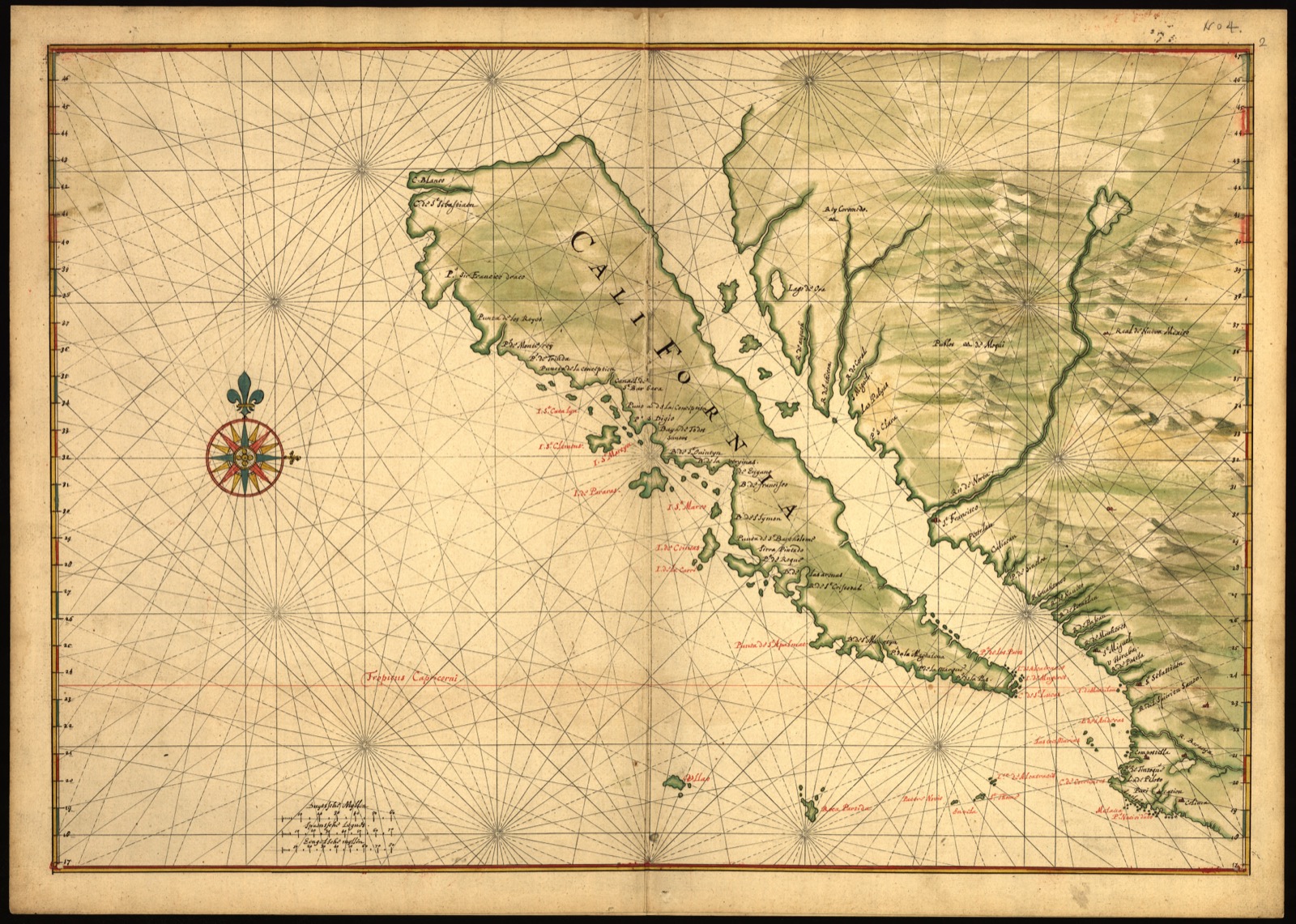
Early Spanish Maritime Map of California Coast (c. 1650)
Historic manuscript chart documenting early Spanish cartography of Alta California harbors.
Other Key Milestones in this Era
Juan Rodríguez Cabrillo Sights the Peninsula
Portuguese navigator sailing under the Spanish crown sails into San Diego Bay, sighting the sandspit.
Don Pedro Carrillo Receives Mexican Rancho Land Grant
Governor Pío Pico grants the Coronado peninsula to Don Pedro Carrillo as a wedding gift.
Captain Bezer Simmons Purchases Coronado for $1,000
American sea captain Bezer Simmons buys the entire 4,185-acre peninsula from Pedro Carrillo for $1,000.
Primary Archival Sources & Official Portals
Share Chronicle & Academic Citation
Distribute verified Coronado historical records or cite this resource in academic, educational, and journalistic works.